


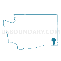
Pomeroy Ward 2, Garfield County, Washington
About
Outline

Summary
| Unique Area Identifier | 684275 |
| Name | Pomeroy Ward 2 |
| County | Garfield County |
| State | Washington |
| Area (square miles) | 0.36 |
| Land Area (square miles) | 0.36 |
| Water Area (square miles) | 0.00 |
| % of Land Area | 100.00 |
| % of Water Area | 0.00 |
| Latitude of the Internal Point | 46.47366960 |
| Longtitude of the Internal Point | -117.60269280 |
Maps


Graphs
Select a template below for downloading or customizing gragh for Pomeroy Ward 2, Garfield County, Washington


Neighbors
Neighoring Voting District (by Name) Neighboring Voting District on the Map
- Pomeroy Ward 1, Garfield County, WA
- Pomeroy Ward 3, Garfield County, WA
- Scoggin Voting District, Garfield County, WA
- Tucannon Voting District, Garfield County, WA